
February 17, 2021 | Engineering + Technology,
Over the past ten years, NRG Systems has built on its wind Lidar experience by offering and supporting a range of remote sensing technologies. Since 2019, our Lidar portfolio has included the ZX 300 Wind Lidar from U.K.-based ZX Lidars. This remote sensor uses Doppler Lidar technology to capture finance-grade wind measurements and is fully IEC-classified and accepted by DNV GL as a Stage 3 Bankable Lidar. A recent survey (doi: 10.5281/zenodo.4302363) by the Consortium for the Advancement of Remote Sensing (CFARS), which NRG is a contributing member of, further cemented ZX 300 as one of the most accurate and flexible Lidars available to the wind industry.
CFARS announced the results of the survey – a first-of-its-kind review of remote sensing devices operating in complex flow – in October 2020. The study’s aggregation of results from various measurement campaigns featured three widely-used remote sensors – ZX 300 Wind Lidar from ZX Lidars, WindCube from Leosphere, a Vaisala company, and Triton Sonic Profiler from Vaisala – and observations enhanced by adjustment methods to increase agreement between the models and co-located cup anemometers being evaluated. The CFARS review involved collecting and analyzing results from its member organizations, which includes remote sensor and wind turbine OEMs, wind developers, academic researchers, and independent engineers, and has not conducted any new measurement campaigns or tests as part of this review.
The CFARS review was especially enlightening in terms of supporting ZX 300 Wind Lidar’s suitability at complex wind sites by demonstrating the technology’s excellent accuracy in high levels of complex flow. The study also demonstrated that ZX 300 Wind Lidar provides highly accurate data in non-homogenous flow conditions. While CFARS has not endorsed full standalone use of remote sensors in complex terrain for bankable WRA, NRG’s view is that the results included in this study do demonstrate that ZX 300 Wind Lidar provides finance-grade data in non-homogenous flow conditions.

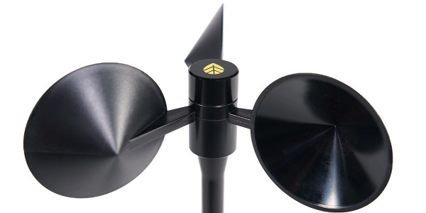
ZX 300 Wind Lidar in complex terrain.
Shortly following the release of the CFARS survey, ZX Lidars launched the ZX Complex Flower Solver (ZX CFS) – a solution developed by German consultancy Deutsche WindGuard (DWG) in partnership with ZephyScience, and with support from ZX Lidars, to turn ZX 300’s excellent accuracy into bankable data. The ZX CFS was recently approved by DWG, marking the first time a leading wind energy consultancy has supported a remote sensor’s suitability for stand-alone use at complex sites.
We discussed the significance of these recent remote sensing developments with NRG Senior Product Manager, Robert Cole, below:
NRG Systems (NRG): To start, can you explain how complex wind sites affect a remote sensor-based measurement campaign? What unique considerations do they present?
Robert Cole (RC): Complex terrain presents challenges for Doppler-based remote sensors because it generally induces non-laminar wind flows, which means the horizontal and vertical wind speed and direction at the various sampling locations for a given range gate will vary. Without proper adjustment methods in place, Doppler Lidars and Sodars rely on the assumption that wind flow is homogenous throughout the measurement volume at each range gate. This assumption then is violated in complex wind flows, particularly when significant off-axis winds are present. The breakdown of this assumption in complex terrain has historically meant that these instruments were not accepted for stand-alone use by technical experts within the industry, although we have still seen them used in conjunction with a met tower at such sites predominantly to validate the shear profile above the top cup anemometer.
NRG: Can you explain why the CFARS survey and its findings are significant?
RC: This is the first literature review of its kind, comparing results from multiple campaigns for the three most used remote sensors in the North American wind energy industry. Accordingly, it is the most objective evaluation to date of the relative strengths of the adjustment methods available for each instrument.
The findings are significant because remote sensors have traditionally not been approved for stand-alone use at project locations with complex wind flow conditions, and the results indicate that much of the disagreement between remote sensors and cup anemometers at these types of sites can be eliminated using methods that are already commercially available to the wind industry.
NRG: What do the findings of this survey mean to someone looking to use Lidar for their measurement campaign?
RC: The results should increase confidence in the use of certain remote sensors at sites with complex wind flows because it demonstrates that today’s adjustment methods can greatly reduce the disagreement between remote sensor and cup anemometer. This is particularly the case for the set of ZX 300 results reviewed by the group.
NRG: Do these findings set ZX 300 apart from other Doppler remote sensors on the market?
RC: Looking at the set of campaigns available to CFARS, the ZX 300 adjustment method certainly stands out. The adjusted data sets achieved an average linear regression slope between Lidar and cup anemometer of 1.0 across the full population of campaigns, compared to 0.98 before adjustment. The results published by CFARS also show that the adjusted data sets have a much smaller range of slopes, varying between 0.98 and 1.02 compared to a range of 0.91 and 1.01 before adjustment. Of the three instruments included in the review, which did not control for terrain or other meteorological differences between sites, the adjusted ZX results are the most statistically promising.
NRG: How was this news received by the wind industry?
RC: The long-term impact of the ZX 300’s proven effectiveness in complex terrain remains to be seen, but the initial reaction from key industry participants has been quite positive. In particular, Johannes Cordes, Wind and Data Analyst for Deutsche WindGuard’s Wind Resource Assessment team, had the following to say in a recent DWG press release on the topic:
“Deutsche WindGuard has been supporting lidar applications since 2004. While stand-alone lidar measurements in flat terrain have already had a high acceptance in the past, we see the particular challenges of stand-alone measurements in complex terrain well addressed and appropriately treated with the ZX CFS application. The design and structure of this service provides the best available solution for bankable wind resource and energy yield assessment based on stand-alone lidar in complex terrain.”
Want to learn more about any of the topics covered in this article? Contact Robert Cole via email at rpc@nrgsystems.com.